
Find the Disappearing Tarn on Mount Wellington, Hobart
The Disappearing Tarn used to be a local secret, a hidden gem. These days, not so much. During COVID-19 in 2020, the Disappearing Tarn went viral across socials, becoming a hotspot for tourists and locals alike. Since then, Wellington Park has decided to provide signage for the Tarn that indicates where to go.
Rather than relying on the signposts for your own journey to the Tarn, you may find this guide helpful, especially in preparation for your hike.
Before anything else, I want to highlight that the conditions on Kunanyi (Mount Wellington) can become so severe that you may need to be rescued. This doesn't happen often, but when it does, you don't want to be caught in it. Common sense is your best friend. If the weather looks bad, snowfall is heavy, you don't have warm clothing and also have no idea how to navigate the mountain, perhaps it's best to stay indoors.
This may seem like common sense, but there are always people who don't follow the above and end up needing rescuing (this recently happened in Sept 2024). Don't let that be you. Instead, use some of the below information and tips to guide you in your preparation.
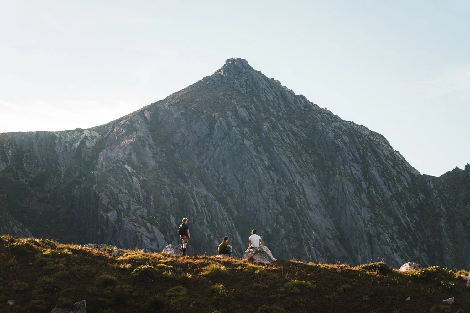
Weather & Terrain
Give yourself at least three hours of good weather forecast before attempting to walk to the Tarn. As a local, and experienced walker, I'd be comfortable walking this in any conditions. If you're also an experienced walker and know how to navigate in snow storms or heavy rain, you'll likely be okay to visit the Tarn at any time. If this is not you, try to reserve this for a day with very light rain or clear skies.
The walk along the Milles track (also known as Wellington Falls track) takes you through different types of terrain, such as muddy tracks reminding you of a narrow fire trail, boulder fields (known as the Potato Fields), and a few steep slippery climbs up trails covered in tree roots. Under certain conditions, usually after snowfall or cold nights, the boulders that replace the trail for vast portions of the trail become slippery and occasionally covered in ice. Keep this in mind.
There is good news though, so if you've been turned away at this point, keep reading, particularly the story just below. There's hope yet.
Equipment (shoes, food, clothing)
Before I dive into equipment, I'd like to share a story from my first visit of the Tarn in 2020 when it went viral across social media.
I arrived at The Springs unable to find a legal park. People were illegally parked everywhere - on yellow lines, across the road, and double parking.. this was not a good start but gives an indication of how many people were around.
As I started walking, I realised this would be a long walk. It felt like I was back in school walking in single file. One step, wait a second, take another step, wait again, step again, etc... Along this long and excruciating walk, I encountered walkers of every kind. Some in shorts, some in sandals and some carrying children in a backpack harness. The rocks were icy at this time and still, people of all ages pressed on. No one gave up and everyone I spoke to said they made it.
With that context, you'll need shoes that are comfortable to walk in, able to get wet and still provide a good amount of grip. I'd go with hiking boots/shoes, but as I observed on my walk, people managed to do it in sandals. Why? No idea. I'd stick with shoes to avoid losing toes to the cold.
Food-wise, bring enough to last you a few hours. If the weather isn't looking ideal, I'd first consider if you need to do the walk and if you insist, perhaps bring more food to last the night if you were to get stuck.
For clothing, you'll need a few layers. It gets cold when you're not moving (often the case once you reach the Tarn and stick around for a while). I'd bring a thermal, windbreaker, beanie and another layer for between the thermal and wind-breaker (chosen depending on the temperature). Pants are great rather than shorts but both work. Again, dress to the conditions.
Distance & Elevation
Walking from the Springs to the Disappearing Tarn along the Wellington Falls (Milles) Track is approximately 9km return with 270m of elevation gain. The terrain is more technical than other walks given the roots, rocks and mud along the trail. For some, this is an instant turn-off. For others like me, this sounds like fun.
You'll want to start at the Springs. Lost Freight is the cafe located here, a perfect place to start for a snack or hot drink before your 9km walk. You want to locate the Milles track on any of the trailhead maps. If you can't find a map, basically just follow the one-way road up to the upper car park (there's a walking track leading up here) and then once here, look for the trail that takes you towards Zig Zag or Milles track (both in the same initial direction). There are plenty of steps up here. You'll know you're in the right spot.
After the stairs, you come to a cross roads. To the right looks like a road to nowhere, straight ahead is the Zig Zag track, and to the left is the Milles track. It's all signposted and on this particular signpost is the Disappearing Tarn, approximately 3.8km away. Walk this way and don't veer off of the trail.
Before long, you'll encounter the Ice house Track signpost. This is a fun walk to the top of South Wellington, but not for today. There'll be another split in the track, also signposted, and it's clear you need to go right, not left.
After further walking, and approximately 3.6km after the Milles Track turnoff signpost, you'll get to the Potato Fields (boulder field). Once you start descending back to trail, the Tarn will be on the right. Maybe 50-100m further walking from here.
You'll either see the beautiful turquoise Tarn and be thankful for the last hour or so of walking, or, you've come when the Tarn is not around and be sad you didn't continue reading this blog to find when the Tarn appears and how to know it's around.
At any point in the walk, ask people for directions if you’re unsure. Most people are friendly and willing to lend a hand.
The Disappearing Tarn appears very rarely, usually only once or twice a year after heavy rainfall or snow. From past experience, I've generally gone in the later months of winter. Tasmania's weather has been unusual the past few years (as of 2024) with large dumpings of snow in late winter or early spring. This has often been paired with rainfall, leading to the formation of the tarn.
Finding the Tarn and knowing when it has appeared is quite easy. The only downside is you can't be the first person to discover it and must rely on others to find it. My approach is to go to Instagram and search for "The Disappearing Tarn" by location. I select the location and look for recent stories or posts. If there's neither a post or story, I'll wait and check back every day until there is.
This method is a waste of time most of the year and should only be done after heavy rainfall or large dumpings of snow. The chances that no one, not even a local Tasmanian, posts to Instagram are very low. I’ve relied on this method every time I’ve visited and have been 100% successful in finding it.
A Tarn is a mountain lake/pool generally formed in glacially carved depressions. This isn't quite the case on Kunanyi as this Tarn is ephemeral, meaning it lasts only for a very short time. Heavy rainfall or large volumes of snow are needed for the Tarn on Mount Wellington to appear.
-
Sadly you can't swim at the Tarn. In the past, many people used to swim but were unaware that the Tarn is in a water catchment area. With the Tarn becoming more popular in recent years, the rules are enforced with hefty fines. Expect to pay a $200 on-the-spot fine or up to $4,040 if taken to court. Instead, maybe stick to the beach.
-
You'll find that the walk to the Disappearing Tarn is around 9km in length with an elevation gain of 265m. As a runner with a high level of fitness, the walk lasted 2 hours and 20 minutes to the Tarn and back. For those who are less experienced, consider giving yourself 3 - 4 hours. This walk is better to take slow and focus on your footing rather than speed up and risk an injury.
-
This depends on when you're asking. We recommend using Instagram to help determine if others have found it before going yourself. See our quick guide on this above.
Discover more for your Tasmanian adventure below!


Season-by-season guide to Tasmania: weather, wildlife, events, and the best times for beaches, hiking, road trips, and the Aurora Australis.